Archive for the ‘Uncategorized’ Category

Week 10 – The Big Two-Oh! Or One-Oh!

Saturday, March 7th, 2020

Last week – The group found their way through a new route on the Tri-Community Bikeway in Stoneham, Woburn, and Winchester. Overall the feedback was good. While the route is marked most of the way, it seem people got a little off track after the second water stop but everyone found their way back on to the bike route. Thanks to Nicole, Bobby, Tom, and Liz for the water stops.

Coronavirus – No matter your opinion of the ongoing coronavirus issue, I’d like to take this time to remind people to practice good hygiene while running. Cough into your elbow or shoulder, minimize touching your hands to your face, limit what you touch at water stops, and keep a few feet distance between you other runners. We won’t be “saving cups” at water stops for the rest of the season to limit the chance that fluids from one cup transfers to another. Candy dishes won’t be put out, but candy will be in cups, and if you want one ask the water stop attendant and he/she will “pour” one into your hand. Let’s limit runners touching bottles and candy bags, and leave it to the water stop volunteers to touch things. As we run through cold, flu, and coronavirus season we, as a group, do a good job keeping healthy. Let’s keep it that way so everyone can get to their races healthy.

This Week – We have the 20 miler for the long route runners and the 10 miler for the half route runners. We have three water stop volunteers, so we’ll keep it to the traditional route shown on the map. Last season I made a slight change to this route and a few got very confused so we’ll save that variation for another day.

The Route –

Start – This week everyone starts down Main Street to West Wyoming where they’ll take a right and run up past Grimsby’s to Spot Pond. Turn right at the pond, past the Stone Zoo, past Friendly’s, straight onto North Border Rd. Continue to a set of lights where you’ll turn left on Marble Street. Marble will become Forest Street as you enter Winchester, where you’ll find a water stop tucked in on Eugene Drive.

Half 2 – The half runners will continue with the long runners, heading down Forest Street and turning left on Highland Ave where the Winchester Hospital direction sign is. Continue on Highland until you find a little park on the right side at the corner of Eaton Street. Turning right on Eaton will bring you down to Washington Street where you’ll turn right. Continue on Washington to the Gingerbread Construction Company and turn right on to Forest Street. Run up, up, and up Forest Street until you find the water stop at Eugene again.

Half Finish – The final leg of the half run will take you back to Melrose the way you came. Go over I-93 on Forest Street as it becomes Marble Street. At the set of lights turn right on Park Street which becomes North Border Road, taking you back past Friendly’s. Continue straight as you go past the Stone Zoo to where Pond Street turns left to head towards Melrose. Run straight past Grimsby’s onto West Wyoming, then turn left on Main Street and get back to Brueggers to finish your 10 Mile run!

Long 2 – The long runners will head down Forest and turn left on Highland with the half runners. Continue straight on Highland, past Winchester Hospital, past where the half runners turn, straight through a 5-way intersection staying on Highland, all the way to the end of Highland where you’ll find a water stop.

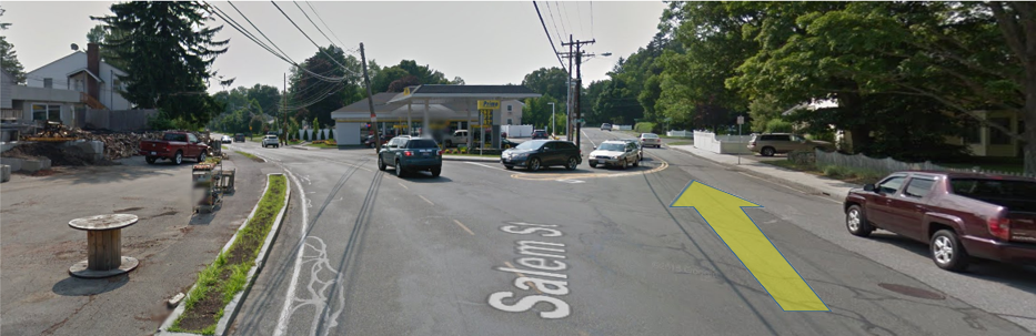
Long 3 – You’ll venture into new terrain for this section. Turn left on Main Street/Rt38 and head to Medford. Cross to the right side of the road and as you run along the wall of the Oak Grove Cemetery, turn right at Playstead Road. This will continue along the cemetery, past a soccer field, along the commuter rail to High Street in Medford. You’ll turn right on High, cross the train tracks, and if you must the Dunkin Donuts has been a convenient rest stop for many years. Continue on High Street, making sure to keep left to stay on High where Grove Street forks off. DO NOT GO ONTO GROVE STREET. High will bring you to the source of the Mystic River. Do not cross the Mystic or you’ll be in Arlington and we don’t go to Arlington. Instead turn right on the Mystic Valley Parkway at the little rotary. Follow this past the Mystic Lakes, which feed the Mystic River, until you get to what seems to be the end of the Mystic Valley Parkway where you’ll turn right on Bacon Street. Follow Bacon under the commuter rail and then take your first left onto Mystic Valley Parkway (told you it wasn’t the end). This part of the Mystic Valley Parkway runs along the Aberjona River, which feeds the Mystic Lakes. Along this stretch will be a water stop, which feeds you.

Long 4 – Continue along the Mystic Valley Parkway, going through a set of traffic lights and then turning left at the next set of lights on to Washington Street. Washington will take you through a five way intersection where you cross Mt Vernon Street and keep right to stay on Washington. If you run past Winchester High School, well you didn’t learn anything the last time we ran through here and are likely to be lost for a while. Washington will cross Winchester taking you over to the Gingerbread Construction Company where you could buy a muffin but won’t, you’ll instead turn right onto Forest Street and head back up, up, up to the water stop at Eugene Drive.

Long 5 – After this water stop you’ll continue on Forest over I-93 as the road becomes Marble Street. You’ll turn right at the lights onto Park Street and continue as that becomes North Border Road. At Friendly’s you’ll turn right onto Main Street and continue as that becomes the Fellsway West. Turn left on Elm Street, which will stay Elm Street all the way up to the rotary at the other Highland Ave. Turn right onto Highland and look for a stop right after you turn.

Long Finish – The final leg of this journey will take you down Highland all the way to the traffic circle at the Fellsway East. Turn left and follow the Fellsway East through our version of Heartbreak Hill as you make your way to Grimsby’s. Here you will happily remember that you can take a right on West Wyoming and a left on Main to finish your 20 Mile run at Brueggers!

Water Stops – There are quite a few stops this week. We should have Bobby, Tom, and myself out there helping you move along.

Roll Call! Who’s in?

Week 9 – Tri-Community Greenway Run

Friday, February 28th, 2020

Last Week – Derm, Bobby, and Nicole helped you get through a hilly 18 mile full run and 9 mile half run SLR on a beautiful day. Each year that is a week where I tell people how the weather challenges in the winter is part of your training and trains you to keep focus through adverse conditions. Well this winter you guys are spoiled! Other than that an inch of slush was the most weather we’ve had to deal with.

This Week – So in the absence of winter weather, we’ll challenge you with a new route, with water stops in places you’ve never seen them before. And to make it more challenging we’ll do it without me being there to tell you the route over and over again. Good luck!!!

The Route – Google Maps hasn’t caught up with the new bike path so instead we’ll just include some Strava Maps. The full SLR page has maps for each route with mile markers, elevation, and water stop locations.
Half Route Full Route

Start – You’ll head out along familiar territory up Main Street to a left on Franklin Street. Run into Stoneham, passing Stoneham High School and Dunkin Donuts. You’ll want to be over to the right side of the road because this week we’ll take the third right after Dunks onto Pleasant Street. Along Pleasant you’ll want to move to the left side of the street as you cross through a 4-way intersection and come to a triangle merge where you’ll go right. Cross to the right side of the road where you’ll enter the Tri-Community Greenway. This bikepath will take you over to Pomworth Park. There is a parking lot there where our volunteers will serve up some treats.

Half 2 – The whole group will continue to follow the greenway, keeping your eyes out for bike route symbols as you jog right on Central Street, left on Elm Street, and cross Main Street as you turn left. The Greenway continues on your right, crossing Montvale Ave and approaching I-93. Before the I-93 tunnel the half route runners will take a sharp left up Maple Street’s steep hill (no walking). You’ll turn right onto Park Street to stop your climb and bring you back to familiar territory. Follow Park through an intersection, past the I-93 on ramp, as it turns into North Border Rd, over to Friendly’s. Cross Main Street straight onto South St and continue as it turns into Pond Street. Look for a water stop at the Stone Zoo.

Half Finish – Finish up by continue on Pond Street along Spot Pond. Turn left to stay on Pond Street as it brings you down to Grimsby’s. Run straight on West Wyoming and left on Main to finish up at Brueggers.

Full 2 – The full route runners will leave water stop 1 with the half runners to follow the greenway. You’ll follow the jog right on Central, left on Elm, and cross Main while turning left to find the greenway on the other side of Main. Cross Montvale on the greenway and continue through the tunnel under I-93. The greenway will run parallel to Montvale Ave with a few street crossings. You’ll continue to follow the greenway as it turns left on a different Central Street in Woburn past a park and cemetery. It then turns left on D-Street and right on Washington Street as it enters Winchester. Watch for the bike lane markers as the path turns off Washington Street along the Aberjona River and over to Cross Street. When you get to Cross Street by railroad tracks look to the right across Cross for the Winchester Community Park for your next water stop.

Full 3 – The next section takes you on a 5 mile loop through Winchester, Woburn and around Horn Pond. Return to the bike path, through a park, past an elementary school, through a neighborhood, to Winchester High School. The bike lane markers will show you the route as it jog left on Irving Street, turn right on Florence Street, another quick jog right on Swanton, and a left on Holland into the parking lot of Winchester High. Turn right on Skillings Rd, cross another Main Street straight on to Lake Street. A quick right will turn onto the Horn Pond Brook Bikeway. This bikeway will bring you onto Middlesex Street which will turn into Sylvester Ave, and the bikeway will cut you through to Lake Terrace to Horn Pond. Turn left on Lake Street (a different Lake Street) here and loop the paved trail around Horn Pond ending up on Arlington Rd along the east side of the Pond. As you finish the loop, turn left on Lake Street and run up to Main Street in Winchester. Cross Main Street to turn left on Cross Street. As you approach the railroad tracks on Cross Street look for the water stop at the Winchester Community Park for water stop.

Full 4 – Continue on Cross Street and quickly turn left on Forest Street. Follow that as it winds over to the Gingerbread Construction Company where you cross Washington Street and run up the familiar hills of Forest Street. No water stop at the top though, continue over I-93 and turn right at the traffic lights onto Park. Now its your turn to follow Park Street past the I-93 on ramp, as it turns into North Border Rd, over to Friendly’s. Cross Main Street straight onto South St and continue as it turns into Pond Street. Look for a water stop at the Stone Zoo.

Finish Full – Finish up by continue on Pond Street along Spot Pond. Turn left to stay on Pond Street as it brings you down to Grimsby’s. Run straight on West Wyoming and left on Main to finish up at Brueggers.

Water Stops – So I’ll be missing the adventure this weekend. Tom, Bobby and Nicole will help you out. The plan will be for them to meet at the first water stop. As the leaders run through Tom can move over to Water Stop 2/3, Nicole will head to Stone Zoo, while Bobby finishes up that stop. Bobby can then move over to Stone Zoo to relieve Nicole and wait for the full runners to move through. Hopefully this plan works for everyone.

Roll Call – Who’s in for the new route!

Week 8 – Getting Longer

Saturday, February 22nd, 2020

Last Week – We did 7 miles for the short and 14 for the long on what ended up being a cooler day than expected. As cloud cover kept the sun from warming us, and a stiff breeze made the wind chill even cooler, the group made their way through Stoneham to Friendly’s and through a series of hills in and about Spot Pond.

This Week – The weather should be sunny with temperatures approaching 40 as we do our last run in February. We’ll be heading over to Breakheart to run part of what was once the Wakefield version of the Law Enforcement Memorial Half, which became Boston’s Run to Remember. The group will be looping Breakheart as we break into the longer training distances of the season with half runners get in 9 miles and the long runners stretching it out to 18 miles.

The Route –

Start 1- This week we start up Main Street towards Ell Pond. Say ‘Hi’ to the Clarence DeMar monument for luck and bear right onto Green Street to a traffic light where you turn left onto the Lynn Fells Parkway. Follow the Lynn Fells all the way to the Saugus entrance to Breakheart on the left. Follow the road up to the upper parking lot at the headquarters building. Look around for Derm in the parking lot for the water stop.

Start 2- All runners, short and long, will head into Breakheart. We’ll be taking the outer loop around Breakheart Reservation. We typically go in the right side and run counterclockwise through the woods, bearing right at the fork in the road at the swimming area. Some runners like to go clockwise, others like to just run the flat side, so feel free to improvise, just don’t cheat yourself out of miles. Make your way back to the headquarters parking lot for a second water stop.

Half-Finish- The half runners backtrack the way they came to finish up their 9 mile run, along the Lynn Fells Parkway to the left on Green Street and back onto Main Street to finish at Brueggers.

Long 3- The long runners will had back along the Lynn Fells but will turn right onto Main Street in Saugus at the first set of lights. The group will continue on Main as it becomes Farm Street in Wakefield and stop at Bobby’s water stop on the right at Wakefield High School.

Long 4- After the water stop you’ll continue on Farm Street to a right onto Water Street and an immediate left onto Montrose Street. This windy hilly road will bring you to its end where you turn left on Salem Street. Salem will fork left, but you’ll bear right onto Lowell Street.

Lowell Street will bring you up to Lake Quannapowitt near the Gingerbread Construction Company. Cross to the left side of the road, turn left onto Quannapowitt Way and look for Nicole at the water stop in the Comverse parking lot.

Long 5- After this stop you’ll make your way over to North Ave, choosing to either go along the dirt path or follow the roadway through the parking lot. At North Ave go left and follow it all the way back to Main Street, where Derm’s final water stop will be waiting for you at Nick’s Pizza.

Long Finish- From here you’re going back to Melrose along Main Street, straight back to Brueggers to finish your 18 miler.

Water Stops- I won’t be around this weekend, but Derm, Bobby and Nicole will be at Breakheart, Bobby and Nicole will head over to Wakefield High School ahead of the pack, and Nicole will eventually make her way to Lake Q to keep up with the pack. After the last runner comes through, the water stop volunteers should pack up and head to the next stop to let the volunteer know who to expect when, with Derm cutting over to Nick’s ahead of everyone. Eventually all water stop help will congregate at Nick’s to finish up the day.

Roll Call! Who’s in?

Week 7 – Good Bye Old Friendly’s

Saturday, February 15th, 2020

Last Week – We had a good crowd come out on a frigid day to explore the streets of Stoneham and the Winchester Highlands. The hilly course challenged us all, working those muscles you’ll need late in the Boston Marathon.

This Week – We’ll be heading out the same start as last week, but working away over to the now defunct Friendly’s at Spot Pond. The full route will circle the backside of the pond, but then head out to the Fellsway East hills. The half route is very much the same as last week’s route, but with a trip to Friendly’s instead of Winchester. It’s been cold this week, but should warm up a bit for Sunday.

1 2 3 4 5 6 7 8 9 10 11 12 13 14 15

The Start – The whole crew will head up Main Street, past Ell Pond where you can tip your hat to Clarence DeMar. If this is your first season with us, you may not have noticed that there is a monument to Clarence DeMar along Ell Pond, remembering a legendary Boston Marathoner who lived and trained in Melrose a century ago. After you pass Clarence, continue on to Franklin Street, where you’ll turn left and climb up to Stoneham. Unlike last week, you’ll continue on Franklin all the way to Stoneham Square, turning left at the end of Franklin on to Main Street. Main Street will bring you up towards Spot Pond. Cross to the right side for a water stop at Friendly’s 4 miles into your run.

Half Finish – Close out your half route, turn left at the lights onto South Street, which will become Pond Street. Follow that past the Stone Zoo and turn left to bring you down to Grimsby’s. Turn left onto the Lynn Fells Parkway, run up past Melrose High School, turning right onto Melrose Street and right again onto Main to finish up your 7.2 Mile run.

Full 2 – The long route will head out straight from Friendly’s around the back side of Spot Pond. Run along the Fellsway West, past the Sheepfold and turn left when you get to Elm Street, which will bring you up to the Highland rotary. Turn right this week, following Highland Ave. The water stop will be somewhere along the Fellway East end of Highland, find it for your next drink.

Full 3 – Leaving the water stop continue along Highland Ave to the traffic circle at the Fellsway East. Now climb up towards the eastern section of the Middlesex Fells, over the two hills I know you’re growing to love, and wind down yourself down to Grimsbys. Turn left and do your best to climb Pond Street back up to Spot Pond. Turn right, pass the Stone Zoo and head back to Friendly’s. Have another drink before finishing your long run.

Full Finish – Head back up Main Street to Stoneham Square, turning right on Franklin Street. Continue back to Main Street in Melrose where you turn right to get back to Brueggers after 14.3 miles behind you.

Water Stops – Two water stops, manned by a combo of Derm at Friendly’s and me at Highland Ave. I will likely join in at Highland and run some modified SLR.

Roll Call – Who’s in?

Week 6 – Off to the Highlands

Saturday, February 8th, 2020

Last Week – While most of the Sunday Long Run crew were off running a race in Cambridge, a handful of runners headed out for the second trip around Breakheart of the season. You know we’ve had a mild winter when we get to run through Breakheart twice! Lets hope this holds up for the rest of the winter.

This Week – Lois and I will be hosting the first SLR run out to Winchester of 2020, along my favorite route of all the SLR routes.

1 2 3 4 5 6 7 8 9 10 11 12 13 14 15 16 17
 
  1 2 3 4 5 6 7 8

Start – Heading north on Main Street, runners leave Melrose by taking a left on Franklin Street and following the road up a hill into Stoneham. Continuing past Stoneham High School on your left and Dunkin Donuts on your right, you’ll turn left at a set of lights on to Summer Street. This street will wind over to Main Street in Stoneham where you’ll go straight across onto Marble Street. Marble takes you to an overpass of I-93 into Winchester where the road turns into Forest Street. On your left you’ll find the water stop on the corner of Eugene Drive.

Half Finish – The half route runners will turn back over I-93 to a set of lights on the corner of Park Street where they’ll turn right taking them over to the now closed Friendly’s in Stoneham. Cross Main Street and continue straight to Pond Street, past the Stone Zoo and turning left to stay on Pond Street down to Grimsby’s. To get your 8.2 miles in you’ll turn left at Grimsby’s onto the Lynn Fells Parkway, running past Melrose High School, and turning right on Melrose Street, and another quick right onto Main Street to finish up at Brueggers.

Full 2 – After leaving the water stop continue on Forest Street, runners will turn left on Highland Ave towards Winchester Hospital. As you approach the hospital, turn left onto Reservoir Road. This will bring you along the edge of the Middlesex Fells, with a view of Winchester’s North Reservoir. As the road becomes Hillcrest Parkway, enjoy your surroundings and ignore the hill you’re running up. The road will eventually bring you back to Highland Ave where you’ll turn left. You’ll reach a 5-way intersection where you’ll continue straight across to stay on Highland Ave. At the end of Highland you’ll find a water stop.

Full 3 – Leaving the water stop, turn right on to Main Street in Winchester. You’ll run up to a rotary, as you circle it counterclockwise you’ll pass a little spur street and then turn on the second street to stay on Main Street. There is a sign for Symmes Farm Historical Site as a landmark to tell you you’re on the right road. Stay to the right side of the street, as you’ll come to a fork where you want to stay to the right to run onto Washington Street. Washington will take you to another 5 way intersection. Cross Mt Vernon Street and stay to the right to keep on Washington Street. If you run past Winchester High School you went the wrong way. Washington will eventually take you to Forest Street, the Gingerbread Construction Company will be the landmark to note that its time to turn. Go right on Forest and climb up a series of hills to get back to the water stop at Eugene.

Full 4 – Leaving the water stop you’ll go over I-93 and turn right at the lights on to Park. Run to Friendly’s and turn right on to Main Street/Fellsway West. This will take you over I-93, past the Sheepfold, under I-93 to Elm Street where you turn left. Elm will take you up to a rotary where you go left and find Flynn Rink. The final water stop will be in the skating rink parking lot.

Full Finish – To finish up the long run continue on Woodland Road to Pond Street, where you turn right to make your way down to Grimsby’s. Continue straight onto West Wyoming and run to Main Street in Melrose. Turn left and finish up at Brueggers.

AltHalf Finish – The alternate half route runners follow the Full 2 and Full 3 sections. After that you still have a few miles more before finishing. Go with the full route runners onto Forest to the set of lights where you turn right onto Park. When you get to Friendly’s turn left on Main Street instead. Main will take you to the intersection with Marble Street where you turn left. Marble will take you back over I-93 to Eugene Drive where you can carpool back.

Water Stops – Lois and I can handle this one but if anyone else wants to help us out, let me know.

Roll Call – Who’s in?